
Hamilton, Ontario
A city of towns,
and a hundred waterfalls.
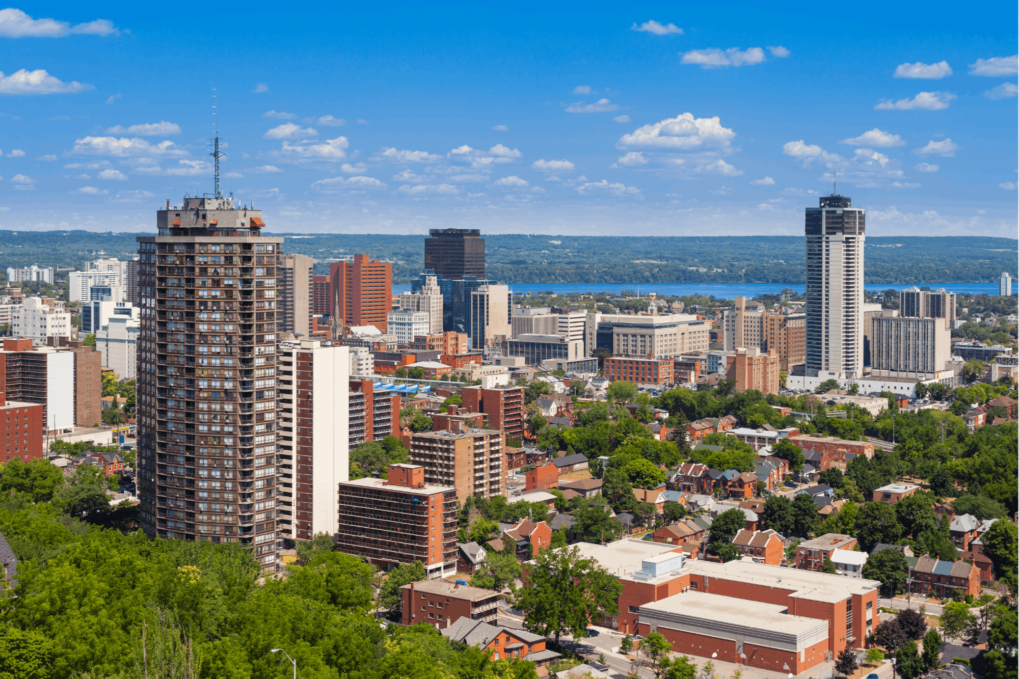
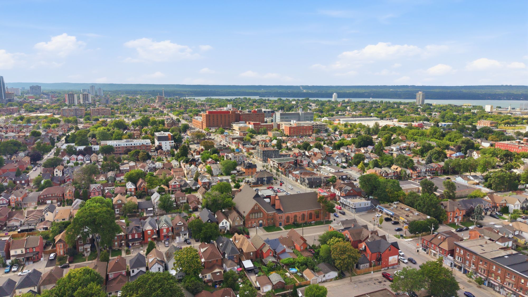
Six former municipalities on a harbour, split in half by the escarpment — with more waterfalls inside the city limits than anywhere else in the country.
Six towns, one city,
and an escarpment through the middle.
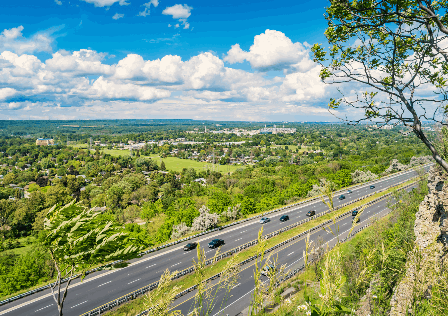
Hamilton sits at the western end of Lake Ontario on Burlington Bay, split by the Niagara Escarpment into the lower city and the Mountain. Incorporated in 1846, it took its present shape in 2001 when Ancaster, Dundas, Flamborough, Glanbrook and Stoney Creek amalgamated into it.
Hamilton — 1,118 km² on the bay
0
Residents
(2021 Census)
0 km²
Land Area
0
Incorporated
0+
Waterfalls
in the City
The City of Waterfalls
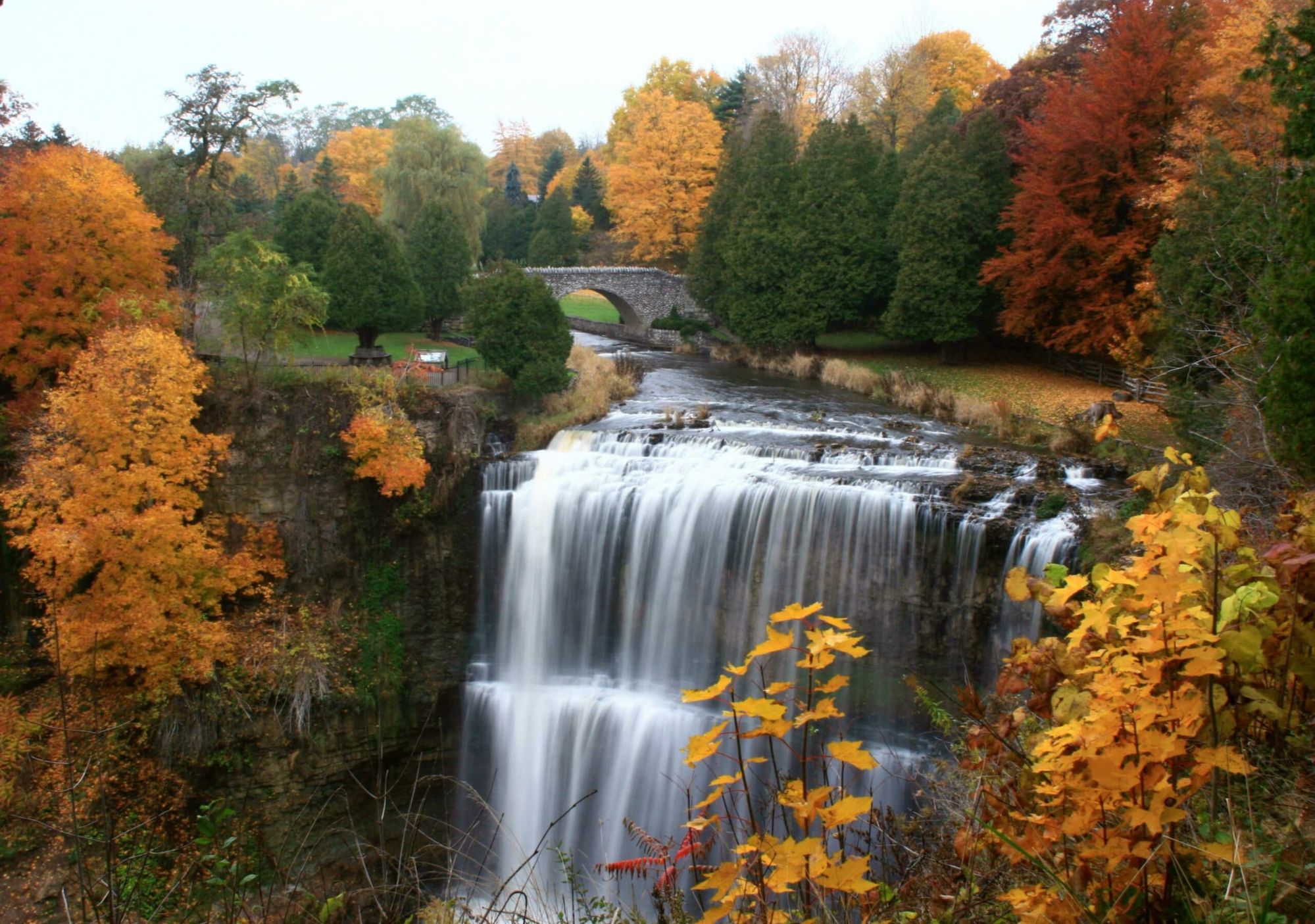
More than a hundred waterfalls and cascades sit inside the city limits, most of them where creeks drop over the Niagara Escarpment.
Lower City and Mountain
The escarpment splits Hamilton in two. Below it, the old grid and the harbour; above it, the Mountain — postwar and newer subdivisions with the views.
Six Towns in One
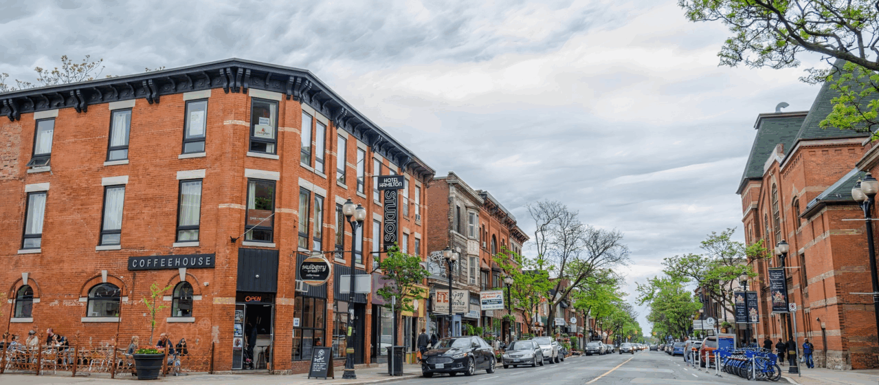
Ancaster, Dundas, Flamborough, Glanbrook, Stoney Creek and the old City of Hamilton amalgamated in 2001 — and each kept its own main street.
A Working Harbour
Hamilton Harbour is one of the busiest ports on the Great Lakes, with Bayfront Park, Pier 4 and the waterfront trail alongside it.
McMaster and Health Sciences
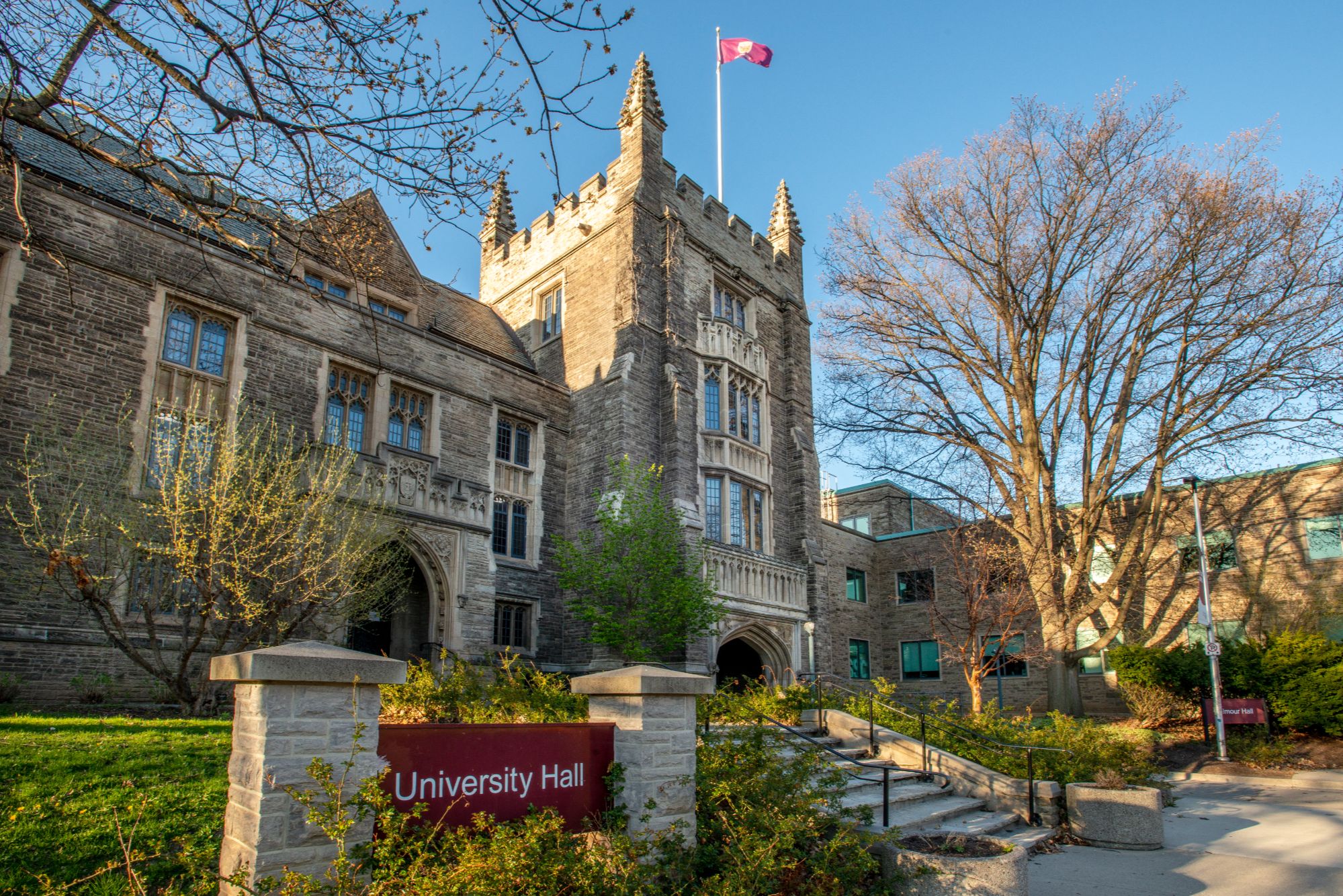
McMaster University sits at the city's west end, and health sciences and education now employ more Hamiltonians than steel does.
A Real Arts Scene
James Street North galleries, Supercrawl each September, the Art Gallery of Hamilton and a music history that keeps producing bands.
Population and land area from the 2021 Census of Population (Statistics Canada). Waterfall count per the City of Hamilton and the Hamilton Conservation Authority.
What People Love
Why people move here
and then stay.
Ask ten Hamilton residents why they chose it and you'll get roughly these six answers.

Fun Facts
Six things you probably
didn't know about Hamilton.
Two centuries between a harbour and an escarpment, and a few surprises along the way.
Over a hundred waterfalls and cascades sit inside the city limits, nearly all of them where creeks tumble over the Niagara Escarpment.
On 1 January 2001, Ancaster, Dundas, Flamborough, Glanbrook and Stoney Creek amalgamated with Hamilton — and never really stopped being their own towns.
Laid out in the 1910s on Garden City principles, Westdale is one of Canada's earliest planned residential neighbourhoods — and still one of its most walkable.
Dundurn Castle, built in the 1830s for Sir Allan MacNab — premier of the Province of Canada — still overlooks the harbour as a museum.
A merchant who bought the land after the War of 1812 and laid out a townsite. The city was incorporated in 1846 and has carried his name since.
Steeltown, the Ambitious City, the Electric City and simply the Hammer — each from a different era of what the place was known for.
Sources include the City of Hamilton, the Hamilton Conservation Authority, the Canadian Encyclopedia and Statistics Canada.
Every corner of the city,
and what it's actually like.
Hamilton isn't one market — it's dozens. Here are the twenty-three that matter most. Choose a neighbourhood to see the schools, parks, commute and housing mix that define it.
Lower City
The core, mid-turnaround
The old commercial centre around King and James, with the GO Centre, the art gallery and a decade of condo and restaurant investment reshaping it.
Schools
Hamilton-Wentworth DSB and Catholic board schools; Mohawk downtown campus
Parks & Green Space
Gore Park, Bayfront Park nearby, Hamilton Farmers' Market
Getting Around
Hamilton GO Centre and West Harbour GO; 403 minutes away
Walkability
Very walkable
Housing
Condos, converted lofts, century row houses
Lower City · Central
Grand houses under the escarpment
Between downtown and the escarpment face, with some of the city's finest Victorian and Edwardian houses alongside mid-century apartment blocks.
Schools
Hess Street PS, Westdale SS nearby
Parks & Green Space
Durand Park, Whitehern Historic House, escarpment stairs
Getting Around
Hamilton GO Centre; 403 at Main
Walkability
Very walkable
Housing
Century homes, converted mansions, apartments
Lower City · West
Locke Street and the stairs
Built around the Locke Street shopping strip with the escarpment at its back. One of the lower city's most consistently in-demand pockets.
Schools
Ryerson Middle, Westdale SS
Parks & Green Space
Chedoke Radial Trail, escarpment access, Victoria Park
Getting Around
Hamilton GO Centre; 403 at Aberdeen
Walkability
Very walkable
Housing
Century homes, semis, some infill
Lower City · Central
Small, central, walkable
A compact neighbourhood south of downtown around Augusta Street's restaurants, with the GO Centre and escarpment stairs both close by.
Schools
Central schools; Mohawk and McMaster campuses reachable
Parks & Green Space
Corktown Park, Augusta Street, Wentworth stairs
Getting Around
Hamilton GO Centre on the doorstep
Walkability
Very walkable
Housing
Row houses, semis, small apartment buildings
Lower City · Harbour
Between downtown and the bay
North of the CN tracks against Hamilton Harbour, with Bayfront and Pier 4 parks, the waterfront trail and a wave of new development along the shore.
Schools
Bennetto Elementary
Parks & Green Space
Bayfront Park, Pier 4 Park, Waterfront Trail
Getting Around
West Harbour GO; 403 close
Walkability
Walkable
Housing
Century workers' cottages, new townhomes and condos
Lower City · West
Quietly central
Between Locke Street and Dundurn north of Main, next to Dundurn Castle and within walking distance of both downtown and Westdale.
Schools
Strathcona Elementary, Westdale SS
Parks & Green Space
Dundurn Castle, Victoria Park, Bayfront nearby
Getting Around
West Harbour GO; 403 at York
Walkability
Very walkable
Housing
Century homes, semis, low-rise apartments
West Hamilton
The planned garden suburb
Laid out in the 1910s on Garden City principles beside McMaster, with its own village high street and Cootes Paradise at the back.
Schools
Westdale SS, Dalewood Middle, McMaster University
Parks & Green Space
Cootes Paradise, Churchill Park, Royal Botanical Gardens trails
Getting Around
West Harbour GO; 403 at Main West
Walkability
Very walkable
Housing
1920s-30s detached homes, student rentals, some infill
West Hamilton
McMaster's other side
South of Main West around the university, a mix of family homes and student housing with quick access to the 403 and the west end.
Schools
Westdale SS, McMaster University
Parks & Green Space
Ainslie Wood park space, Chedoke trails nearby
Getting Around
403 at Main West; West Harbour GO
Walkability
Walkable
Housing
Post-war detached homes, student rentals
East Hamilton
Ottawa Street and around it
Built around the Ottawa Street fabric and antiques district, one of the east end's strongest neighbourhoods and a long-running first-time buyer entry point.
Schools
Memorial Elementary, Sir Winston Churchill SS
Parks & Green Space
Gage Park nearby, Ottawa Street BIA
Getting Around
Hamilton GO Centre by car; Red Hill Valley Parkway
Walkability
Walkable
Housing
Century and post-war detached homes, semis
East Hamilton
Barton Street, changing
North of Main between Wentworth and Gage, with the Barton Street strip slowly rebuilding and some of the lower city's most affordable housing stock.
Schools
Cathy Wever Elementary, Sir John A. Macdonald SS
Parks & Green Space
Powell Park, Gage Park nearby
Getting Around
Hamilton GO Centre; QEW at Burlington Street
Walkability
Walkable
Housing
Century row houses, semis, small multiplexes
East Hamilton
Around Gage Park
Wrapped around Gage Park east of downtown, with mature trees, larger lots than most of the lower city and a long-established family feel.
Schools
Delta SS, Memorial Elementary
Parks & Green Space
Gage Park, Rosedale Arena nearby
Getting Around
Hamilton GO Centre; Red Hill Valley Parkway
Walkability
Walkable
Housing
Century and inter-war detached homes
East Hamilton
Under the escarpment, east
Tucked against the escarpment in the far east of the lower city, close to the Red Hill trail system and the parkway.
Schools
Sir Winston Churchill SS, Rosedale Elementary
Parks & Green Space
Rosedale Park and Arena, Red Hill Valley Trail, King's Forest
Getting Around
Red Hill Valley Parkway; QEW at Centennial
Walkability
Car-dependent
Housing
Post-war detached homes, bungalows
Hamilton Mountain
Above the city, established
The older part of the Mountain along Concession Street, with an escarpment-edge shopping strip, hospital nearby and views over the lower city.
Schools
Westmount SS, Sir Allan MacNab SS
Parks & Green Space
Sam Lawrence Park, Mountain Brow trail, Limeridge Mall nearby
Getting Around
HSR routes across the Mountain; LINC and 403
Walkability
Somewhat walkable
Housing
Post-war bungalows, side-splits, some rebuilds
Hamilton Mountain
Family streets and schools
West of Upper James, largely built through the 1960s to 1990s. Established, quiet and popular with families moving up from the lower city.
Schools
Sir Allan MacNab SS, Mohawk College nearby
Parks & Green Space
Chedoke Golf Course, Scenic Drive lookouts, Mohawk Sports Park
Getting Around
LINC and 403; HSR across the Mountain
Walkability
Car-dependent
Housing
Detached homes, townhomes
Hamilton Mountain
Newer, and close to the parkway
East of Upper Wentworth, with newer subdivisions, the Limeridge shopping area and immediate access to the LINC and Red Hill.
Schools
Sherwood SS, Bishop Ryan CSS
Parks & Green Space
Mohawk Sports Park, Eastmount Park, Red Hill trails
Getting Around
LINC and Red Hill Valley Parkway
Walkability
Car-dependent
Housing
1970s onward detached homes, townhomes
West · Valley
The valley town
A former town in a valley cut into the escarpment, with a genuine Victorian high street, the Dundas Valley trails and a fiercely local identity.
Schools
Dundas Valley SS, Highland PS
Parks & Green Space
Dundas Valley Conservation Area, Spencer Gorge, Webster's and Tew's Falls
Getting Around
403 at Main; Hamilton GO Centre by car
Walkability
Very walkable
Housing
Victorian and Edwardian brick, mid-century, limited new build
West · Above the escarpment
Heritage core, executive edges
One of the oldest settlements in the area, with a historic village core, the Ancaster Mill, and executive subdivisions spreading out around it.
Schools
Ancaster HS, Frank Panabaker Elementary
Parks & Green Space
Dundas Valley trails, Tiffany Falls, Fieldcote Museum
Getting Around
403 at Wilson; Aldershot GO by car
Walkability
Car-dependent
Housing
Heritage homes, executive detached, newer subdivisions
East
Old town on the lake
A former town at the eastern end of the city, with a heritage main street, Battlefield Park and a long stretch of lakeshore.
Schools
Orchard Park SS, Cardinal Newman CSS
Parks & Green Space
Battlefield Park, Confederation Park, Fifty Point
Getting Around
Confederation GO; QEW at Centennial
Walkability
Somewhat walkable
Housing
Post-war and heritage homes, new builds toward Winona
East · Above the escarpment
Where the new houses are
Above the escarpment east of the Red Hill, one of the fastest-growing parts of the city with subdivisions built from the 1990s onward.
Schools
Bishop Ryan CSS, Saltfleet DHS
Parks & Green Space
Valley Park Community Centre, Felker's Falls, Devil's Punchbowl
Getting Around
Red Hill Valley Parkway and LINC; Confederation GO
Walkability
Car-dependent
Housing
New detached homes, freehold townhomes
East · Lakefront
Orchards turning into streets
The city's eastern edge against Grimsby, historically fruit country and now one of the busiest new-build corridors between the QEW and the lake.
Schools
Winona Elementary, Orchard Park SS
Parks & Green Space
Fifty Point Conservation Area, Winona Park
Getting Around
Confederation GO; QEW at Fifty Road
Walkability
Car-dependent
Housing
New detached homes and townhomes, older farmhouses
North
A village at the top of the falls
North of the escarpment against Burlington, built around Great Falls and a compact main street, with heavy new development on the edges.
Schools
Waterdown DHS, Guy B. Brown Elementary
Parks & Green Space
Great Falls, Smokey Hollow, Bruce Trail
Getting Around
Aldershot GO about ten minutes; 403 and 407
Walkability
Somewhat walkable
Housing
Century homes in the core, new subdivisions around it
North · Rural
Countryside inside the city
The rural north, with hamlets like Carlisle, Freelton and Millgrove, farmland, conservation areas and the largest lots in the city.
Schools
Flamborough Centre schools, Waterdown DHS
Parks & Green Space
African Lion Safari, Christie Lake, Bruce Trail
Getting Around
Highway 6 and 401; car essential
Walkability
Car-dependent
Housing
Country properties, estate lots, hamlet housing
South · Above the escarpment
New streets in old farmland
The city's southern edge, where Binbrook has grown quickly from a village into a full subdivision community with Mount Hope and farmland around it.
Schools
Bellmoore Elementary, Saltfleet DHS
Parks & Green Space
Binbrook Conservation Area, Bloomfield Park
Getting Around
Highway 6 and the LINC; Hamilton Airport nearby
Walkability
Car-dependent
Housing
New detached homes, townhomes, rural properties
Neighbourhood boundaries vary between sources, and school catchments change — always confirm the catchment for a specific address with the Hamilton-Wentworth District School Board or Hamilton-Wentworth Catholic District School Board before relying on it.
Homes in Hamilton
See what's on the market
right now.
Every active listing across Hamilton, updated as it comes to market. Not sure which corner of the city fits? We're along the lake in Oakville — come ask us.


